Old Pictures of the Moody Ridge area (Northern Califorina, USA)
02/29/2000 - Created - Wow! A leap day
03/03/2003 - Moved to RichT.FreeShell.Org
Always ..... Incomplete
Some of the pictures below are from the Online Archive of California at
www.oac.cdlib.org
The Thomas Moran picture came from the Making of America - Digital Library at moa.umdl.umich.edu
Old Pics
Alfred A. Hart Pics
- Hart # 70 - Blasting at Chalk Bluffs above Alta - Cut 60 feet deep.
- Hart # 71 - Building Bank across Canyon Creek. 87 feet high.
- Hart # 72 - Culvert at Canyon Creek. 180 feet long - 12 feet span.
aka Culvert at Canyon Creek, 185 feet long, 12 feet span.
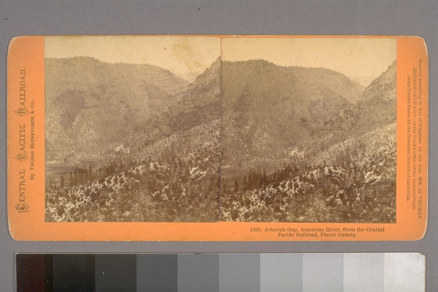
- Hart # 76 - Giant's Gap, American River, 2500 feet perpendicular. 72 miles from Sacramento.
aka Giant's Gap. 2500 feet perpendicular.
Same As Houseworth #1093
- Hart # 77 - Green Valley and Giant's Gap. American River 1500 feet below Railroad.
Same As Houseworth #1094
- Hart # 78 - Green Bluffs, 1,500 above American River. 71 miles from Sacramento.
- Hart #153 - Hog Back Cut, 60 feet deep. 2 miles above Alta
- Hart #154 - American River, from Green Bluffs
- Hart #155 - View of the Forks of the American River, 3 miles above Alta
Houseworth Pics
- Houseworth #1093 - Jehovah Gap, American River, from the Central Pacific Railroad, Placer County.
Same As Hart #76
- Houseworth #1094 - Green Valley, American River from the Central Pacific Railroad, 4 miles above Alta, Placer County.
aka Green Valley, American River, from the Central Pacific Railroad, 4 miles above Alta, Placer County.
Same As Hart #77
- Houseworth #1222 - Green Valley and American River, from the Central Pacific Railroad, above Alta.
- Houseworth #1227 - American River Cańon, from the Central Pacific Railroad, 4 miles above Alta.
- Houseworth #1228 - American Cańon, from the Central Pacific Railroad, 4 miles above Alta.
- Houseworth #1229 - Deep Cut Above Alta, Central Pacific Railroad.
- Houseworth #1230 - American Cańon, from the Central Pacific Railroad, 3 miles above Alta.
- Houseworth #1231 - American Cańon, from the Central Pacific Railroad, 3 miles above Alta.
- Houseworth #1306 - Candle Rock -- Above Alta, C.P.R.R. 500 feet below.
aka - Candle Rock above Alta--Central Pacific Railroad track 500 feet below.
- Houseworth #1308 - Rocky cut above Alta.
- Houseworth #1309 - Rocky cut above Alta -- and American River, 2,000 feet below.
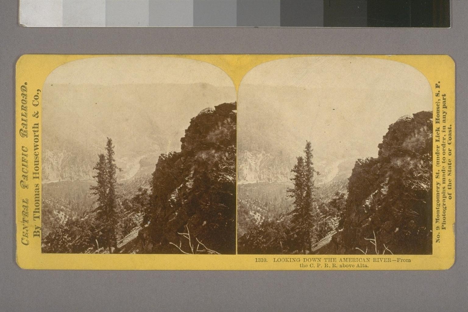
- Houseworth #1310 - Looking down the American River -- from the Central Pacific Railroad above Alta.
aka Looking down the American River -- From the C. P. R. R. above Alta
- Houseworth #1311 - American Cańon and cut above Alta.
Edward J. Muybridge Pics
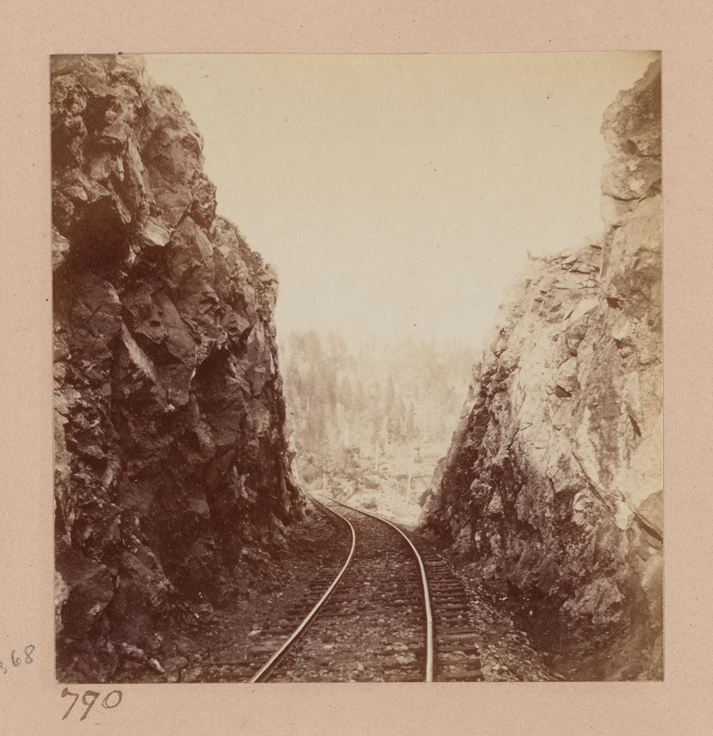
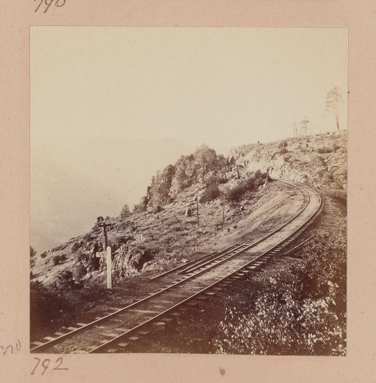
- Muybridge #790 - Eureka Cut, between Shady Run and Alta, looking West.
-
Source
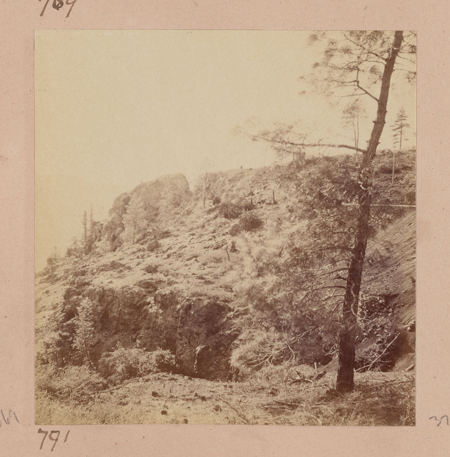
- Muybridge #791 - ? -
Source
- Muybridge #792 - Eureka Cut, between Shady Run and Alta, looking west.
-
Source
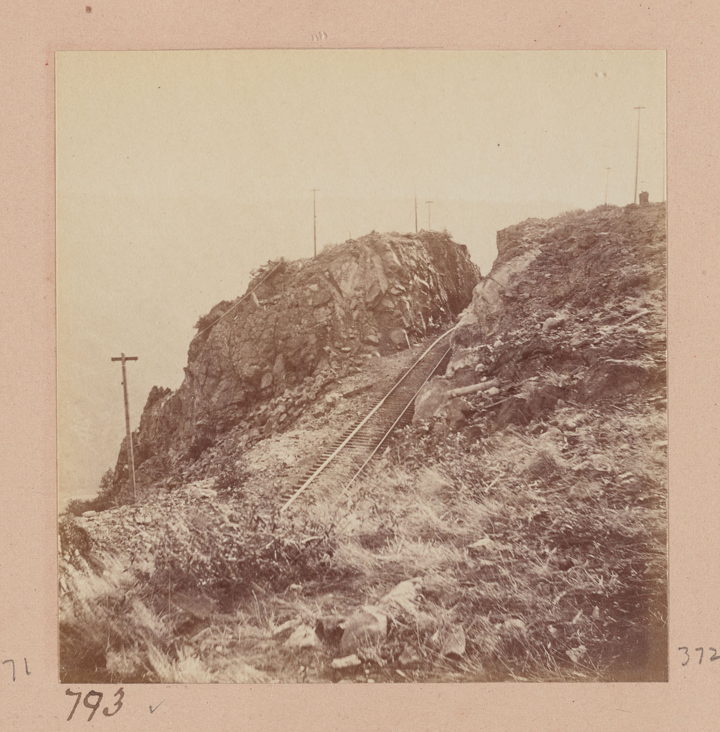
- Muybridge #793 - ? -
Source
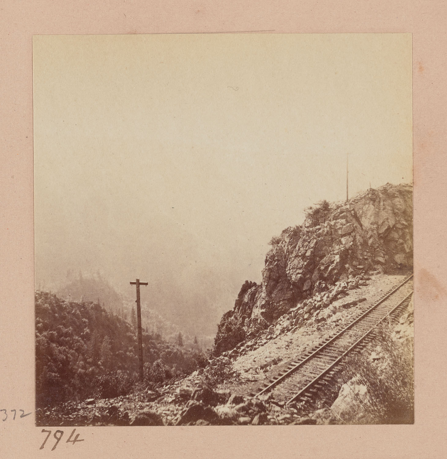
- Muybridge #794 - Green Valley from Eureka Cut, looking West. -
Source
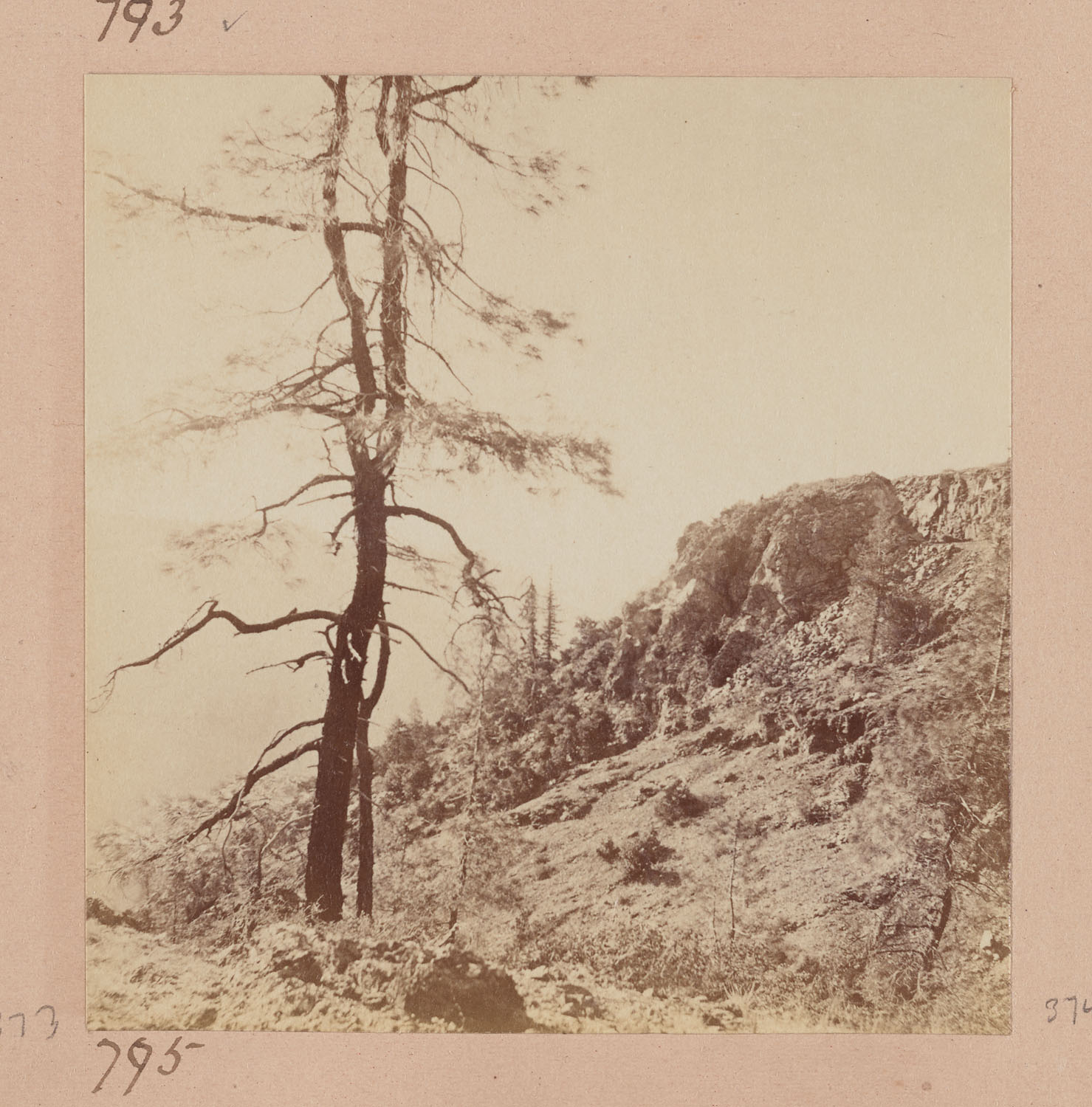
- Muybridge #795 - Eureka Cut, looking West. -
Source
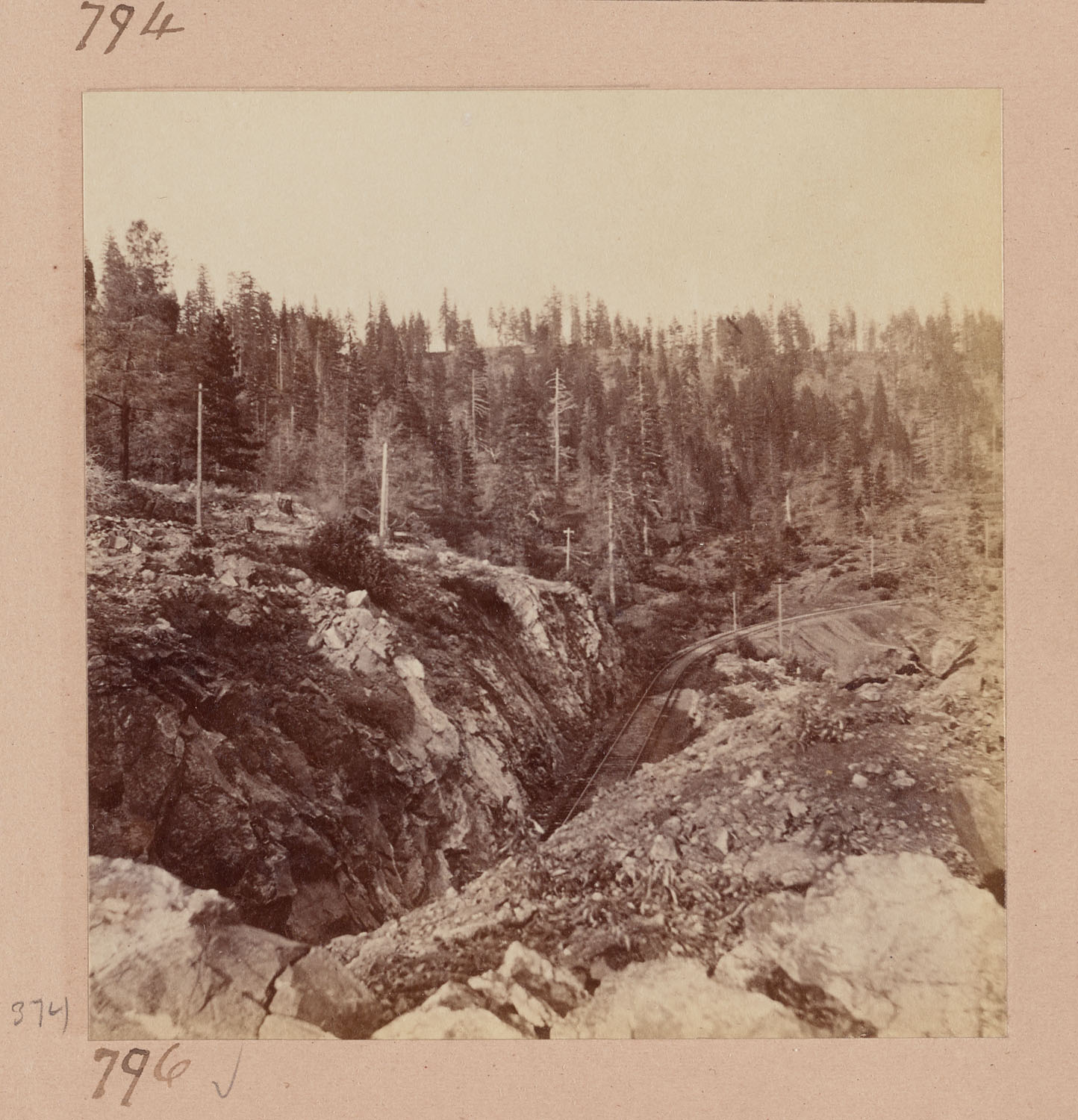
- Muybridge #796 - Eureka Cut, looking East. -
Source
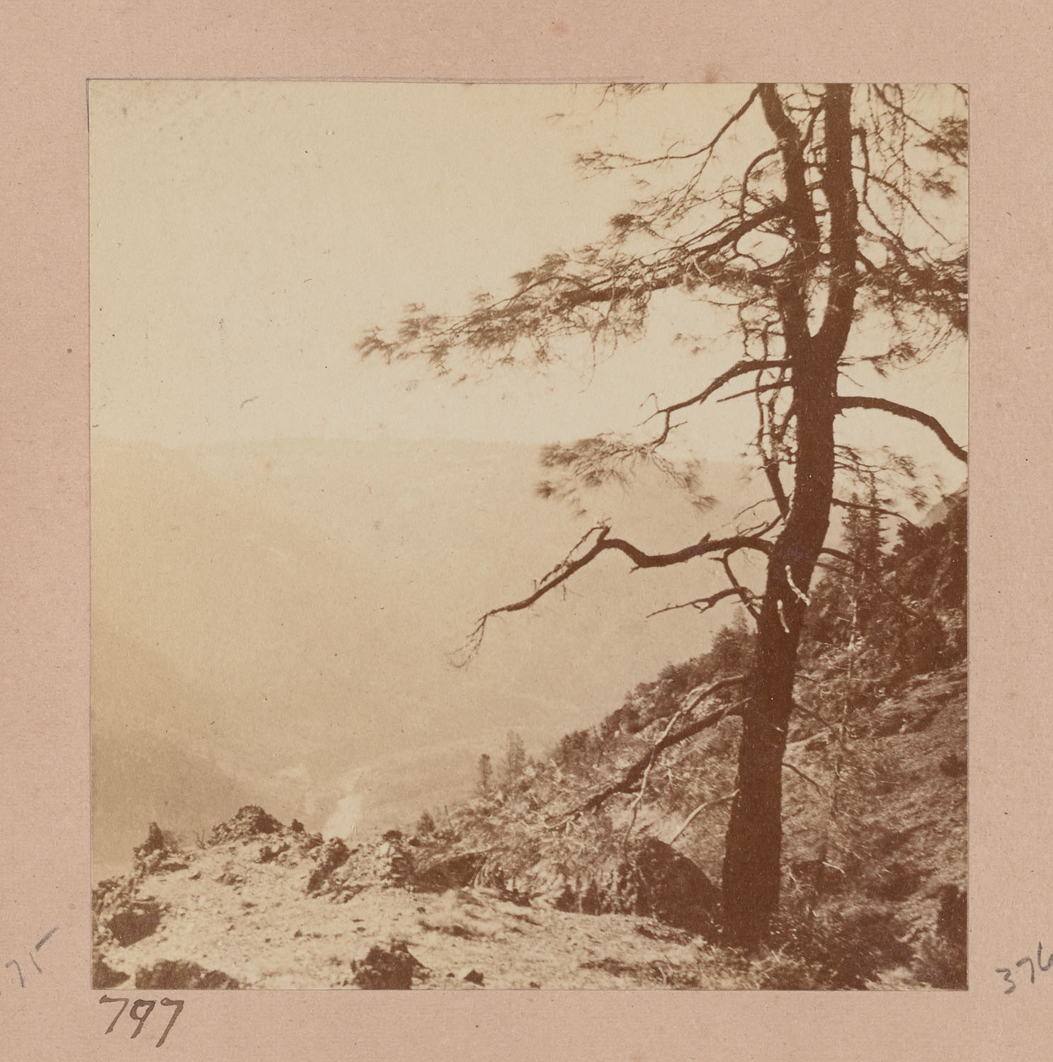
- Muybridge #797 - Green Valley from Eureka Cut, looking West. -
Source
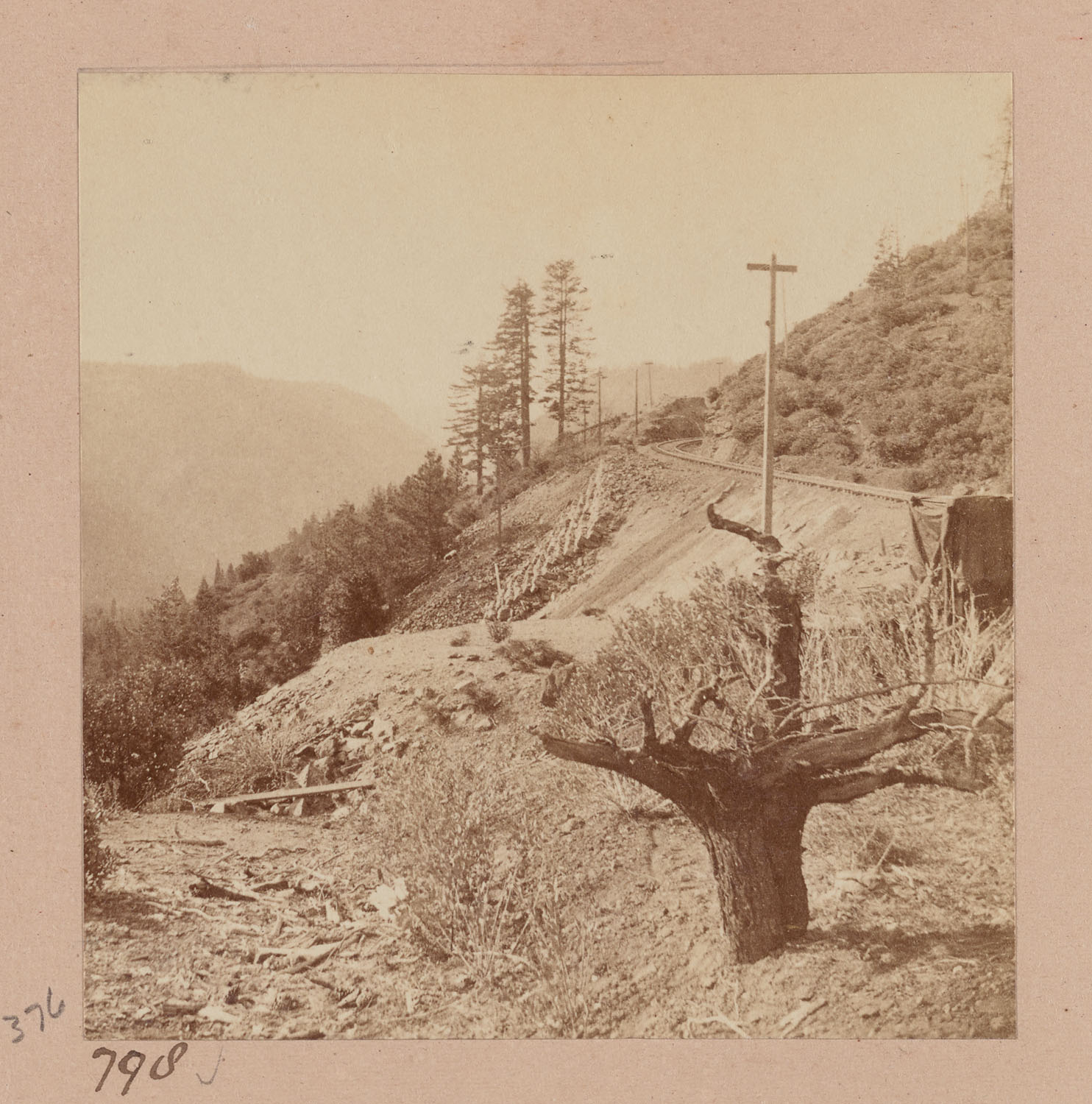
- Muybridge #798 - Tri-Kanyon, point between Shady Run and Alta, looking West. -
Source
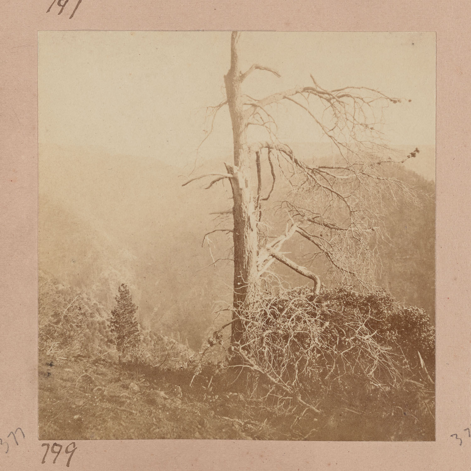
- Muybridge #799 - Tri-Kanyon, point between Shady Run and Alta, looking East. -
Source
- Muybridge #800 - Giant's Gap from Tri-Kanyon, point looking West.
- Muybridge #831 - Candle Rock, near Alta, Railroad 500 feet below.
Charles R. Savage Pics
- Savage #??? - North Fork American River -- above Alta
- Savage #??? - Rock Cut, Above Alta
Carleton Watkins Pics
- Watkins #76 - Giant's Gap, American River, 2,500 feet perpendicular. 72 miles from Sacramento.
Same as Hart #76
"California as I Saw It:" First-Person Narratives of California's Early
Years, 1849-1900 --- http://memory.loc.gov/ammem/cbhtml/cbhome.html
A Brief History of Giant Gap by Russell Towle
Giant Gap received its name as early as 1849, possibly
1848. It is not a "mountain pass" but a gorge, on the North Fork American.
The cliffs stand fully 2500 feet above the river. Inasmuch as a goodly
number of 49ers hailed from the eastern US, where names such as "Cumberland
Gap" denote places where a river has evidently cut a path through a ridge,
it was an easy step to name this gorge Giant Gap. You will also see it as
Giant's Gap. In 1865 or 66, there was apparently a brief effort to change
the old name to Jehovah Gap. It didn't stick.
Just upstream from Giant Gap is Ąone of the many places
named Green Valley, where 2000 people mined for gold in 1851 and 1852.
But my own sources mention Giant Gap as early as 1849 ĄReminiscences of Illinoistown,
by Morgan Fairchild, in Thompson & West, History of Placer County, 1882.
Giant Gap is one of the most beautiful places in California.
An etching by Thomas Moran may be seen in the Pacific Tourist Ą1878, and
it has been painted by many people. All the old guidebooks to California
wax eloquent about Giant Gap.
In some books about the railroad, you will find pictures
of Giant Gap mislabeled "Cape Horn." It was always regarded as the most beautiful
scene along the entire 3000 miles of the Pacific Railroad. An Easterner had
read of the 49ers and the wild canyons of the Sierra Nevada. Here, then,
it was, even wilder and steeper than one had guessed.
The Advance of the Iron Horse from the Sacramento Union, August
14, 1866
"...The scenery along the route of this section is grand
indeed. Four miles beyond Alta is Jehovah Gap, between high and precipitous
mountains, through which, on a clear day, the traveler may see the green
foothills, the tawny plains and the glittering thread of the Sacramento.
Above the Gap, fifteen hundred feet below the railroad grade, is Green Valley,
where several thousand miners found employment in the flush days of gold-digging."
Nelsons' Pictorial Guide-Books.
Opposite Alta, and at no great distance from it, lies
the Grand American Canyon, one of the wildest and most magnificent ravines
in the Sierra Nevada. The river is here confined between two perpendicular
walls, each about 2000 feet in height, which are washed perpetually by the
boiling waters, and leave not an inch of ground for the foot of the would-be
explorer.
Click here to return to the
Towle Home Page